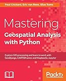
Mastering geospatial analysis with python: Explore GIS processing and learn to work with GeoDjango CARTO frames and MapboxGL- Jupyter Paul Crickard
Material type: TextPublication details: Birmingham, Packt Publishing, 2018.Description: x, 421pISBN:
 - 9781788293334
- 910.285 CRI/M
| Item type | Current library | Collection | Call number | Status | Date due | Barcode | |
|---|---|---|---|---|---|---|---|
 Books
Books
|
Kerala University of Digital Sciences, Innovation and Technology Knowledge Centre GIS(Geographical Information System) | Geographical Information Systems/ Spatial Data Analysis | 910.285 CRI/M (Browse shelf(Opens below)) | Available | 5516 |
Browsing Kerala University of Digital Sciences, Innovation and Technology Knowledge Centre shelves, Shelving location: GIS(Geographical Information System), Collection: Geographical Information Systems/ Spatial Data Analysis Close shelf browser (Hides shelf browser)
| No cover image available |

|

|

|

|

|

|
||
| 910.285 CHR/E Exploring geographic information systems | 910.285 CLA/G Getting started with geographic information systems | 910.285 CLA/G GIS applications in agriculture : Invasive species, Vol. 3 | 910.285 CRI/M Mastering geospatial analysis with python: Explore GIS processing and learn to work with GeoDjango CARTO frames and MapboxGL- Jupyter | 910.285 CRO/G GIS and public health | 910.285 CRO/G;1 GIS and public health | 910.285 DAL/M Mathematical techniques in GIS |
There are no comments on this title.
Log in to your account to post a comment.

